


Pangarchulla Peak Trek is at an elevation of 15,096 feet and is a 5-night 6-day thrilling sojourn. On this trek, you go through the pilgrimage sites of Uttarakhand. The trek starts and ends at Dhak village which is some kilometers away from the base camp “Joshimath market”. Pangarchulla peak is great in summers and thrilling in winters; this is a delight for adventure enthusiasts in the Himalayas
See firstly, the trekking distance is a total of by taxi 560 Km on both sides and on foot 34 km which is to be covered in 5 nights and 6 days. Rishikesh to Rishikesh
Trekking
See firstly, the trekking distance is a total of by taxi 560 Km on both sides and on foot 34 km which is to be covered in 5 nights and 6 days. Rishikesh to Rishikesh Pangarchulla Peak is located in Chamoli District of Uttarakhand and it extends from 15096 feet, Trek – A beautiful mini peak near to Kauri Pass trek in Uttarakhand. The Pangarchulla Peak trek is a popular and challenging trek located in the Garhwal region of Uttarakhand, India. The trek offers breathtaking views of snow-capped peaks, beautiful meadows, and dense forests.Pangarchulla Peak Trek
tunning views: The trek offers stunning views of some of the highest peaks in India, including Nanda Devi, Kamet, and Dronagiri. You’ll also get to see beautiful meadows, glaciers, and valleys.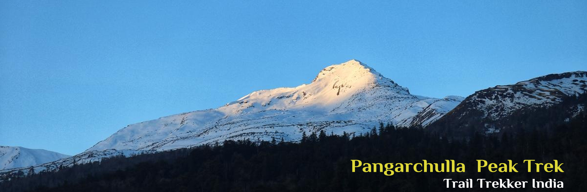
Altitude Gain: 2,089 ft to 8,530 ft | Drive Distance: 280 km | Drive Duration: 9 to 10 hours | Overnight Stay: Joshimath Hotel Dhaneesh (Twin Sharing) | Pick-up point for Himalayan Hikers trekkers: Prince Chowk, nearby Dehradun Railway Station
Route: Dehradun → Rishikesh → Devprayag → Srinagar (Garhwal) → Rudraprayag → Karnaprayag → Nandaprayag → Joshimath
Route: The most common route from Rishikesh to Joshimath is via Devprayag, Srinagar, Rudraprayag, Karnaprayag, Chamoli, and finally reaching Joshimath. This route offers stunning views of the Himalayan ranges, lush green valleys, and rivers flowing through narrow gorges.
Views: Throughout the journey, you’ll be treated to panoramic views of the Himalayas, including peaks like Nanda Devi, Trishul, and Dronagiri. The route passes through several small towns and villages, allowing you to experience the local culture and lifestyle of the Garhwal region.
Joshimath Stay: Joshimath serves as a base camp for trekkers heading to popular destinations like Valley of Flowers, Hemkund Sahib, and Auli. There are various accommodation options available in Joshimath ranging from budget guesthouses to mid-range hotels. You can choose a place to stay based on your preferences and budget.
Activities in Joshimath: While in Joshimath, you can explore the nearby attractions such as the Narsingh Temple, Shankaracharya Cave, and Kalpavriksha. You can also take a cable car ride to Auli, known for its skiing slopes and panoramic views of the Himalayas.
Devprayag: After traveling for about 70 kilometers from Rishikesh, you’ll reach Devprayag, where the Alaknanda and Bhagirathi rivers merge to form the Ganges. The confluence point is a sight to behold, with the contrasting colors of the two rivers meeting amidst the towering mountains.
Devprayag to Srinagar: From Devprayag, the road continues along the banks of the Alaknanda River. The scenery becomes more dramatic as you ascend into the mountains. You’ll pass through small towns and villages nestled in the valleys, with terraced fields and dense forests surrounding the road.
Srinagar to Rudraprayag: As you proceed further, the road follows the course of the Alaknanda River, offering stunning views of the river gorge and the mountains beyond. Rudraprayag, another important town on the route, is known for its confluence of the Alaknanda and Mandakini rivers.
Rudraprayag to Karnaprayag: The journey continues through picturesque mountain landscapes, with the road winding its way up and down the valleys. You’ll pass through dense forests, cascading waterfalls, and terraced fields, with the snow-capped peaks of the Himalayas visible in the distance.
Karnaprayag to Chamoli: The route from Karnaprayag to Chamoli offers some of the most breathtaking views of the journey. You’ll pass through narrow gorges and steep cliffs, with the river flowing far below. The road climbs higher into the mountains, offering panoramic vistas of the surrounding peaks.
Chamoli to Joshimath: The final stretch of the journey takes you through mountainous terrain, with the road hugging the slopes of the Himalayas. As you approach Joshimath, you’ll be greeted by views of snow-capped peaks and dense forests. The town of Joshimath itself is located at an altitude of over 6,000 feet and offers stunning views of the surrounding mountains
Altitude Gain: 7,545 ft to 8,530 ft to 9,264 ft | Trek Distance: 3 km | Trek Duration: 3 to 4 hours | Trek Difficulty: Easy to Moderate | Overnight Stay: Gulling Campsite (Twin Sharing)
Travel from Joshimath to Tugasi by taxi, which is a distance of approximately 15 kilometers. Once you reach Tugasi, you can start your trek to the Gulling camp viewpoint on the same day.
Trek from Tugasi to Gulling: Once you reach Tugasi, you can begin your trek towards the Gulling camp viewpoint. The trail from Tugasi to Gulling is approximately 03 kilometers and can take around 3/4 hours, depending on your pace.
Enjoy the Viewpoint: As you trek from Tugasi to Gulling, you will be treated to beautiful views of the surrounding mountains, forests, and valleys. The Gulling camp viewpoint offers a panoramic vista of the Himalayan landscape.
Overnight Stay: After spending some time at the Gulling camp viewpoint and enjoying the scenery, you can either choose to camp overnight at Gulling.
Please note that the trekking time and distances mentioned are approximate and can vary depending on your fitness level and the pace at which you trek. It’s advisable to start early in the day to allow ample time for the trek and ensure that you have enough daylight to reach your destination.
Altitude Gain: 9,264 ft to 11,014 ft | Trek Distance: 5.5 km | Trek Duration: 8 to 9 hours | Trek Difficulty: Easy to Moderate | Overnight Stay: Khullara Campsite (Twin Sharing)
Wake up early in the morning and do not miss the morning sight of Chaukhamba peaks. After having breakfast leave for khullara camp. Apologies for the confusion in my previous response. The Pangarchulla Peak trek does not typically include a campsite or viewpoint called “Gulling” or “khullara campsite.” Therefore, there may have been a misunderstanding or misinformation.
On this delightful trail, you hike through fairytale-like forests of oak, rhododendron, and walnut trees. Once you start climbing and getting away from the denser fall of trees, you begin to get the first glimpse of the breathtaking snow-capped peaks like Dronagiri, Nanda Devi, Hathi-Ghoda Parvat. You will see many occurrences of natural beauty as this trail varies greatly, and you should have a high probability of noticing Himalayan birds, mossy boulders, and mountain streams as you walk…. and on a clear day, the sunlight through the tree covers can add a lovely luminosity to the trail.
Altitude Gain & Loss: 11,014 ft to 15096 ft to 11,014 ft | Trek Distance: 13 km | Trek Duration: 10 to 12 hours | Trek Difficulty: Moderate | Overnight Stay: Khullara Campsite (Twin Sharing)
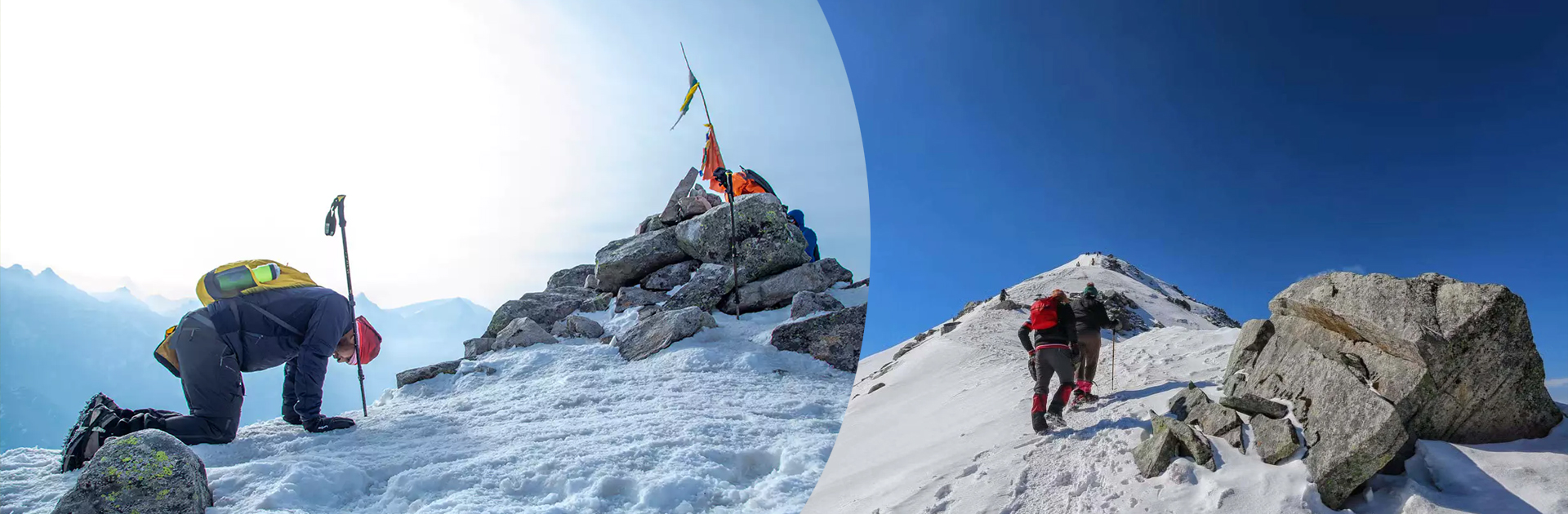
The Trek from Khullara Camp to Pangarchulla Peak summit is a challenging yet rewarding adventure, offering stunning views of the surrounding Himalayan peaks.
Distance and Elevation: The distance from Khullara Camp to Pangarchulla Peak summit is approximately 5-6 kilometers one way, with an elevation gain of around 700-800 meters. Pangarchulla Peak stands at an altitude of 15,096 feet (about 4600 meters) above sea level.
Level of Difficulty: The trek from Khullara Camp to Pangarchulla Peak summit is considered to be challenging due to its steep ascent and high altitude. The terrain involves rocky trails, scree slopes, and possibly some snow patches, particularly in the early season. Trekkers should be physically fit, acclimatized to high altitude, and have prior trekking experience.
Route:
The route from Khullara Camp to Pangarchulla Peak summit starts with a gradual ascent from the campsite, following a well-defined trail through alpine meadows and rocky terrain.
As you gain elevation, the trail becomes steeper and more challenging, with sections of scree slopes and loose rocks. Trekking poles may be helpful for stability, especially during the ascent.
The final stretch to the summit involves a steep climb, possibly with some scrambling over rocks. The trail may narrow and become more exposed as you approach the peak.
The route is marked by cairns or trail markers, but it’s important to proceed with caution and follow the guidance of your guide or trek leader, especially in areas with difficult terrain.
Views:
The trek to Pangarchulla Peak summit offers breathtaking views of the surrounding Himalayan peaks, including Nanda Devi, Trishul, Chaukhamba, and Kamet, among others.
As you ascend higher, you’ll be rewarded with panoramic vistas of snow-capped mountains, deep valleys, and alpine meadows stretching out below.
The summit of Pangarchulla Peak provides a spectacular vantage point to admire the beauty of the Garhwal Himalayas, making the challenging trek well worth the effort.
Duration:
The trek from Khullara Camp to Pangarchulla Peak summit and back typically takes around 8-10 hours, depending on your pace, weather conditions, and trail conditions.
It’s advisable to start early in the morning to allow plenty of time for the ascent and descent, and to return to Khullara Camp before nightfall.
Overall, the trek from Khullara Camp to Pangarchulla Peak summit offers an unforgettable adventure in the heart of the Himalayas, with stunning views and a sense of accomplishment awaiting those who reach the summit.
Altitude Loss: 11,014 ft to 8,530 ft to 7,545 ft | Trek Distance: 8.5 km | Trek Duration: 6 to 7 hours | Drive Distance: 15 km | Drive Duration: 30 minutes to 1 hour | Pangarchulla Peak Trek Drop-off point: Manali Mall Road by 2:00 PM
The trek from Khullara camp to Tugasi Village and the subsequent drive back to Joshimath can be done on the same day.
Trek from Khullara camp to Tugasi Village:
Start early in the morning from the Khullara campsite.
Descend from Khullara towards Tugasi Village, following the trail downhill.
The trek from Khullara to Tugasi Village is approximately 8.5 kilometers and can take around 6-7 hours, depending on your pace and the trail conditions.
Drive from Tugasi Village to Joshimath:
Once you reach Tugasi Village,Himalayan Hikers arrange transport from Tugasi Villarage to Joshimath.
The drive from Tugasi Village to Joshimath is approximately 15 kilometers and takes about 30-45 minutes, depending on the road conditions.
Return Time and Viewpoints:
The return time from Tugasi Village to Joshimath can vary depending on your specific arrangements and the pace of your trek.
During the drive from Tugasi Village to Joshimath, you can enjoy the scenic beauty of the surrounding mountains, valleys, and rivers. You may also have opportunities to stop at viewpoints or take short breaks to admire the landscape and capture photographs.
Altitude Loss: 8,530 ft to 2,089 ft | Drive Distance: 280 km | Drive Duration: 9 to 10 hours | Drop-off point for Himalayan Hikers trekkers: Prince Chowk, nearby Dehradun Railway Station
Route: Joshimath → Nandaprayag → Karnaprayag → Rudraprayag → Srinagar (Garhwal) → Devprayag → Rishikesh → Dehradun
Today’s last breakfast with Himalayan Hikers After breakfast leave early 6 am, have your lunch en route and you can reach Dehradun evening between 6 to 7 pm,
The return journey from Joshimath to Rishikesh typically involves a scenic drive through the mountains, offering beautiful views of the valleys, rivers, and Himalayan landscapes. The distance from Joshimath to Rishikesh is approximately 280 kilometers, and the drive takes around 9-10 hours, depending on the road and traffic conditions.
During the drive, you may pass through picturesque towns and villages, such as Chamoli and Devprayag, where you can witness the confluence of rivers and visit temples or other attractions. The road winds through the mountains, offering glimpses of the stunning natural beauty of the region.
It’s always advisable to start early in the morning to allow ample time for the drive and to avoid traffic congestion. Along the way, you can take breaks at roadside dhabas.
Inclusion
Exclusion